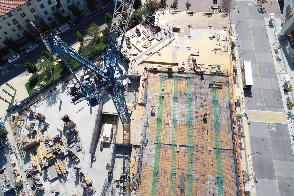


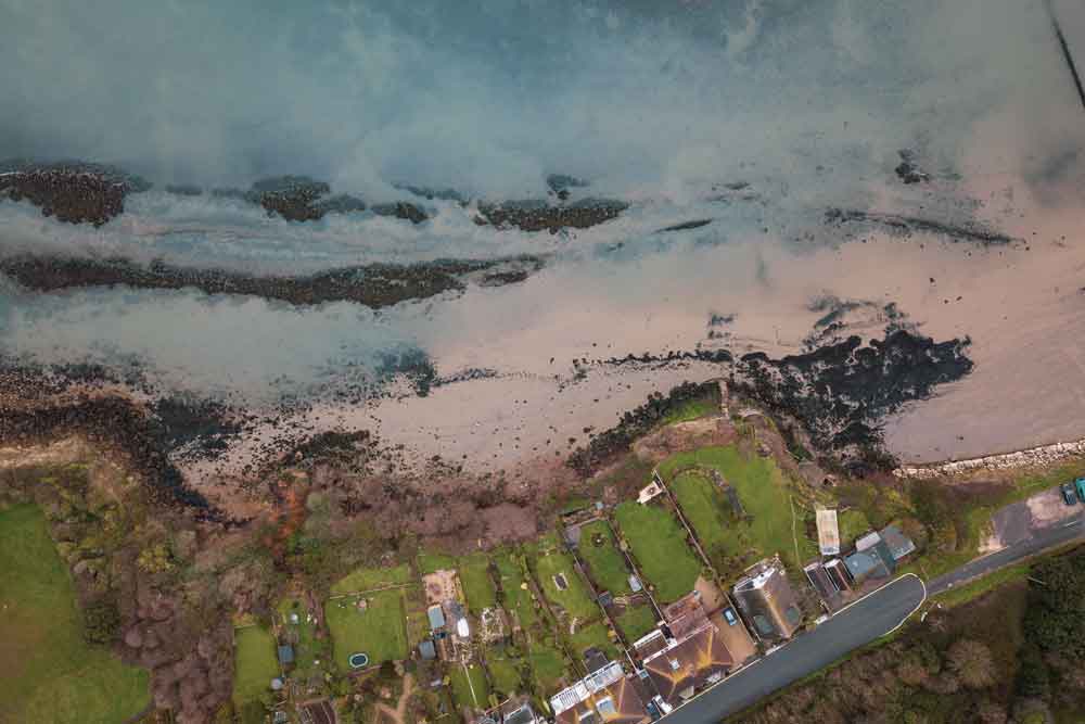

Orthomosaic Maps
3D Point Cloud
Digital Surface Models (DSM)
Oblique Camera Map
Orthomosaic Maps

Orthomosaic maps provide significant benefits to the GIS industry. They offer an accurate representation of the Earth’s surface, integrating georeferenced spatial information with high-resolution details.
This enables precise measurements, accurate analysis, and effective change detection and monitoring. Orthomosaic maps facilitate data integration, aid decision-making processes, and enhance communication through visually appealing representations, ultimately contributing to improved analysis, understanding, and management of spatial information in various industries.
3D Point Cloud

The utilisation of 3D point clouds in the GIS industry brings valuable benefits. By capturing vast amounts of spatially accurate 3D data from sources like photogrammetry, point clouds provide a comprehensive representation of the physical environment.
This enables precise measurements, detailed analysis, and advanced modelling of objects and terrain. The richness of 3D information allows for enhanced visualisation, accurate volumetric calculations, improved infrastructure planning, and simulations for various applications such as urban planning, disaster management, environmental assessment, and asset management. Overall, 3D point clouds greatly enhance the understanding, analysis, and decision-making capabilities within the GIS industry.
Digital Surface Models (DSM)

Digital Surface Models (DSMs) offer several benefits in the GIS industry. By providing a detailed representation of the Earth’s surface, including terrain and above-ground features, DSMs enable accurate elevation modelling and visualisation.
This information supports various applications such as flood modelling, line-of-sight analysis, viewshed analysis, and solar potential assessment. DSMs also aid in infrastructure planning, urban development, and environmental management by allowing for precise volumetric calculations, terrain analysis, and identification of landform changes over time.
With their ability to capture and analyse elevation data, DSMs significantly enhance decision-making processes and provide valuable insights for spatial planning and analysis in the GIS industry.
Oblique Camera Map

Oblique camera maps provide significant benefits in the GIS industry. By capturing aerial images from multiple angles and perspectives, oblique camera maps offer a comprehensive view of the built environment.
These maps provide a detailed representation of buildings, structures, and landscapes, enabling accurate measurements, visual assessments, and precise feature extraction. The oblique imagery enhances visualisation, making it easier to interpret and understand spatial relationships.
Oblique camera maps are particularly useful in urban planning, emergency response, and infrastructure management, allowing for better assessment of building conditions, site analysis, and situational awareness.
Overall, oblique camera maps offer valuable insights and support informed decision-making in various GIS applications.